How long the Camino de Santiago de Compostela really is
If you want to know how long the Camino de Santiago de Compostela is, the short answer is: it depends on the route you choose — because the Camino de Santiago is not one single path, but a network of routes converging on the Cathedral of Santiago, in Galicia. The distance can range from a little over 100 km (62 miles) to almost 800 km (500 miles), depending on where you start.
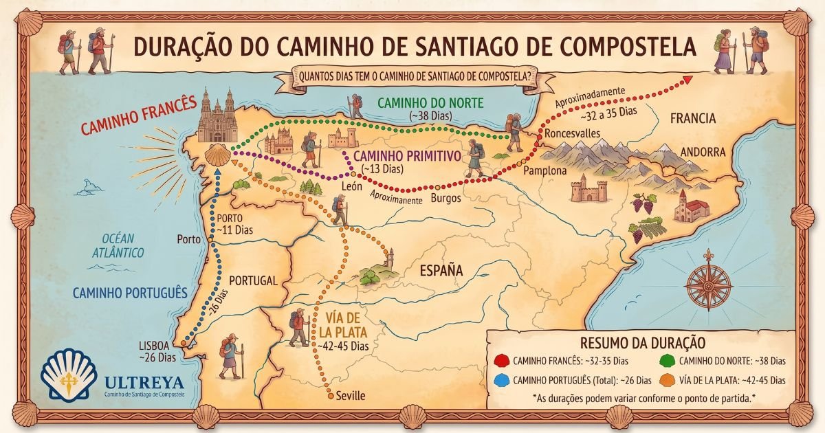
Camino de Santiago de Compostela: how long each route is
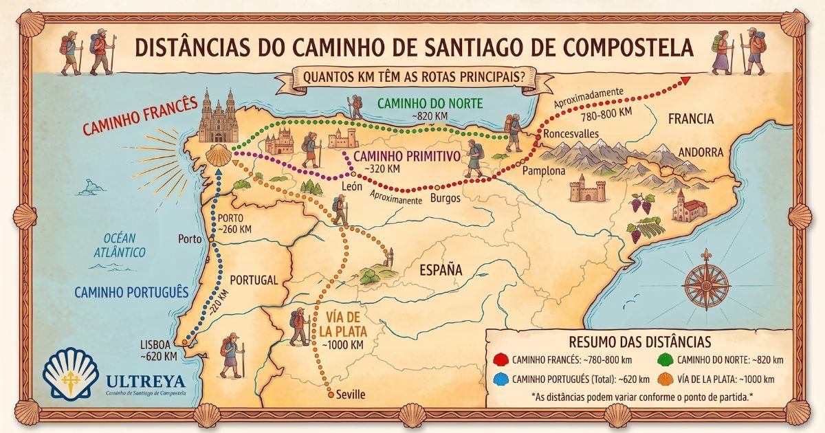
These are the main routes and their approximate distances to Santiago:
- Camino Francés, from Saint-Jean-Pied-de-Port (France): about 780 km (485 miles) — the most traditional and most walked route in the world.
- Camino Francés, from Sarria: about 115 km (71 miles) — the shortest option that still earns you the Compostela.
- Camino Portugués Central, from Lisbon: about 619 km (385 miles).
- Camino Portugués Coastal: about 265 km (165 miles).
- Camino Primitivo, from Oviedo: about 316 km (196 miles) — considered the original Camino, the first one ever walked.
- Camino del Norte, from Irún: about 833 km (518 miles) — the longest of the main routes.
- Camino Inglés, from Ferrol: about 122 km (76 miles).
You can see each route in detail — map, stages, best season and what to expect — in the complete guide to the Camino de Santiago de Compostela.
To answer how long the Camino de Santiago de Compostela is, the right question is not “how long is the Camino”, but “how long is my Camino” — because each route tells a different part of the same story.
“A good pilgrim does not count the miles. A good pilgrim counts the experiences.”
How many miles are left to Santiago from each stop on the Camino Francés
Since the Camino Francés is by far the most popular route, it is worth knowing how far Santiago still is from some of its best-known points:
- Saint-Jean-Pied-de-Port: about 780 km (485 miles) to Santiago — the traditional starting point, at the foot of the Pyrenees, on the French side.
- Roncesvalles: about 750 km (466 miles) — the first stop after crossing the Pyrenees, already on Spanish soil, and where many pilgrims officially “start” counting their Camino.
- Pamplona: about 680 km (423 miles) to Santiago — still early on the route, in the Navarre region.
- Logroño: about 600 km (373 miles) — capital of La Rioja, also famous for the vineyards the walk crosses.
- Burgos: about 480 km (298 miles) — marking the transition between the Castilian Meseta and the rest of the route.
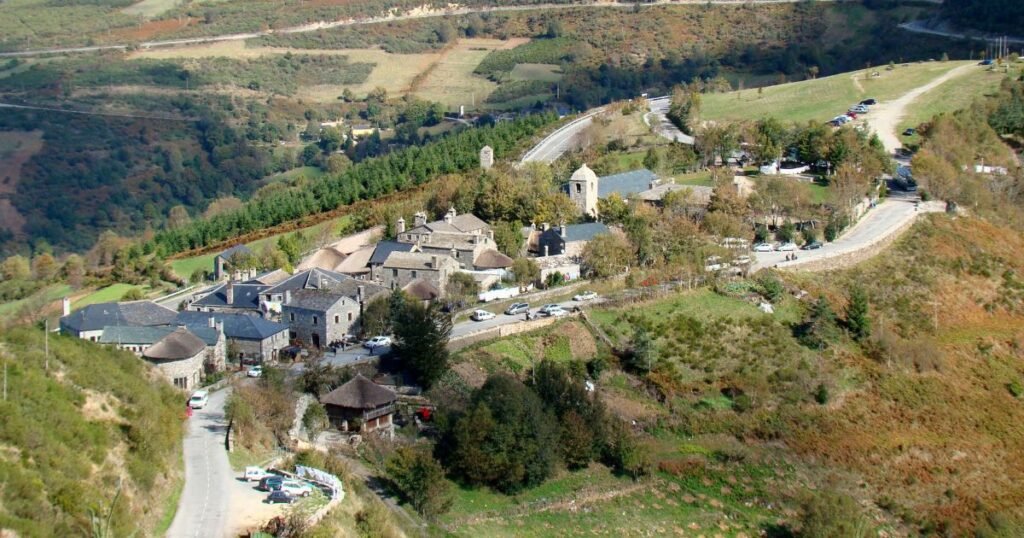
- O Cebreiro: about 150 km (93 miles) — the last big climb of the Camino Francés, and the gateway into Galicia.
If you want to get to know this route in depth — map, stage-by-stage breakdown and the best time of year to walk it — the complete guide to the Camino Francés brings it all together on one page.
How far do I need to walk to receive the Compostela?
Whichever route you choose: to qualify for the official Compostela certificate, the rule is to cover at least 100 km (62 miles) on foot — or 200 km (124 miles) by bike — to Santiago, with your credential stamped along the way. That is why sections such as Sarria–Santiago or Tui–Santiago (on the Camino Portugués) are so popular with anyone short on time.
From Astorga to Santiago: how far is it?
One of the most common questions from people who have already decided to walk the Camino Francés but do not want to (or cannot) do the full 780 km from France is about the final stretch: from Astorga to Santiago de Compostela it is about 260 km (162 miles).
On that stretch, the Camino passes some of the most symbolic landmarks of the whole route: the Cruz de Ferro (where pilgrims from all over the world leave a stone brought from home), Ponferrada — home to the imposing Castillo Templario, built by the Knights Templar in the 12th century to protect the pilgrims passing through — and the climb to O Cebreiro, about 150 km (93 miles) from Santiago, which marks the entrance into Galicia. From there the Camino drops through Triacastela to Sarria, just 115 km (71 miles) from Santiago de Compostela: not by chance, it is the most popular starting point on the entire Camino Francés, since it is the minimum distance required for anyone who wants to walk just enough to receive the Compostela. After Sarria comes Portomarín, about 90 km (56 miles) from Santiago: a curious village, rebuilt stone by stone on a nearby hill when the original valley was flooded to build a dam in the 1960s — even the medieval church of San Juan was reassembled, block by block, in its new location. After Portomarín come Palas de Rei, Melide (famous for pulpo a la gallega) and Arzúa — cheese country, with its own protected designation of origin, Queso Arzúa-Ulloa — before you finally reach Obradoiro Square and its majestic Cathedral of Santiago de Compostela.
In the end, the miles are only a number. Walking is the best way to think — and every stage, short or long, is part of the same journey.